
Spatial Intelligence for
High-Stakes Decisions
We help executives, investors, and institutions answer critical questions where location matters—from infrastructure siting and market entry to climate risk and urban systems.
Trusted by global institutions and industry leaders


What We Offer
Spatial Strategy & Advisory
Location and data strategy
Climate & regulatory risk assesment
Applied GeoAI & Modeling
Site selection engines
Catchment & mobility analytics
Scenario simulation & infrastructure modeling
Custom Spatial Intelligence Solutions
National & global geospatial diagnostics
High-resolution urban analytics
Large-scale geospatial system architecture
Selected Case Studies
Strategic Geospatial Intelligence in Action
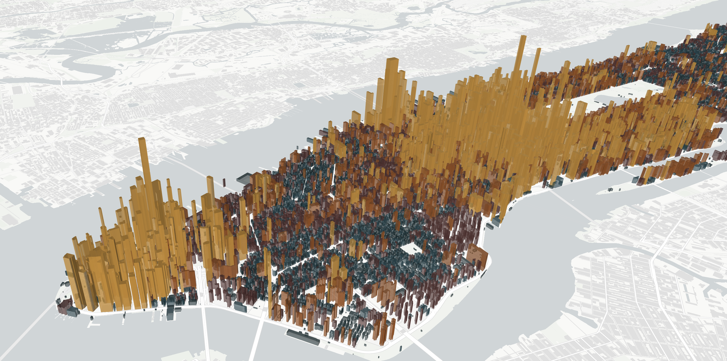
Hyperscale Infrastructure Intelligence
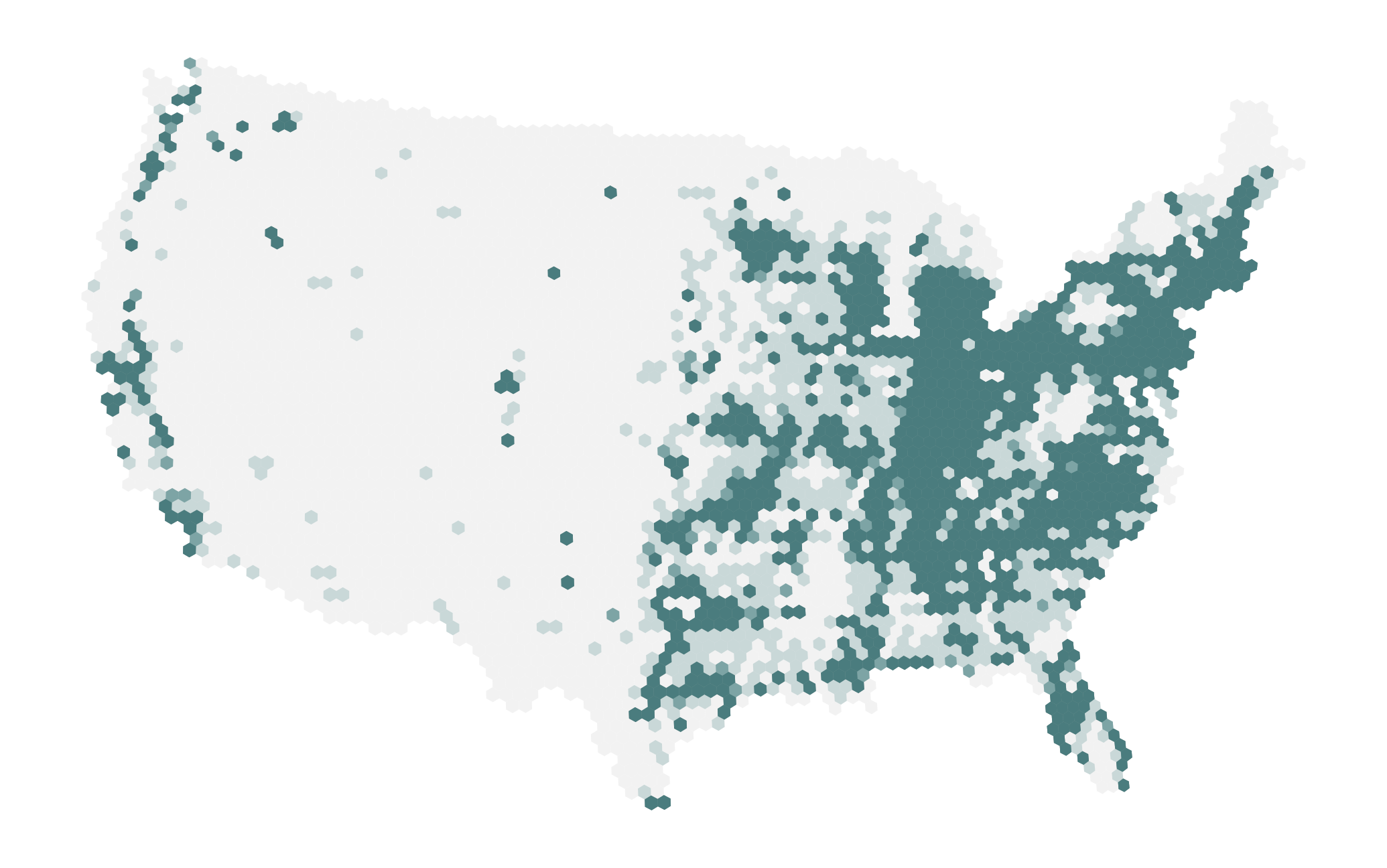
Developed a national geospatial intelligence framework identifying where hyperscale data centers can still be built under current power-grid, land-use, and climate constraints.Moves beyond demand forecasts to quantify the physical limits of AI infrastructure expansion.
Strategic Output:
A national feasibility envelope highlighting constrained hosting capacity — supporting grid planning, infrastructure strategy, and long-horizon capital allocation.
Retail Competitive Site Optimization
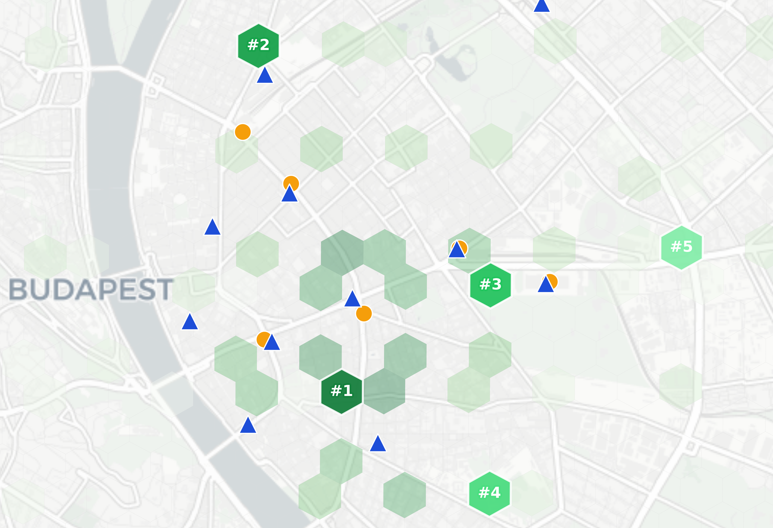
Developed a city-scale geospatial optimization framework identifying where a fast-food chain should expand next, scoring urban zones by population density, transit accessibility, mobility patterns, competitive saturation, and more.
Strategic Output:
A ranked shortlist of expansion-ready locations with network-accurate pedestrian catchments and competitive pressure scores.
Global Construction Activity Intelligence
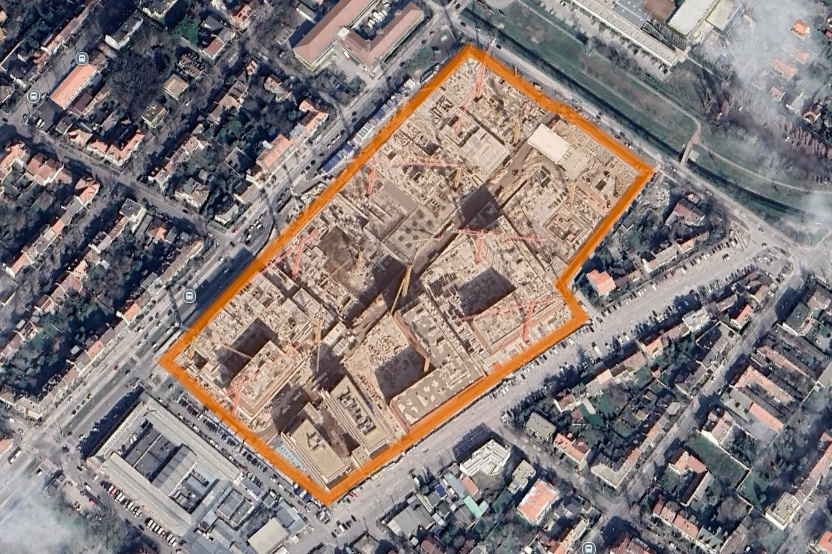
Built a scalable geospatial monitoring framework detecting active construction across global metropolitan regions using multi-temporal satellite imagery.
Transforms raw earth-observation data into forward-looking real estate supply signals.
Strategic Output:
Market-level construction activity indices and spatially resolved project detection for early-stage supply intelligence.
Who we are
We build geospatial intelligence systems for location-critical decision-making.
Operating at national and global scales, we translate satellite data, mobility patterns, urban systems, and spatial infrastructure into clear strategic signals.
From hyperscale data centers, commercial real estate, and retail networks to urban development and construction activity, we quantify what is, or predicted to be physically and economically possible.
Our work sits at the intersection of geospatial data science, cities, infrastructure, and real-world decision systems.

Milan Janosov, PhD
Founder & Geospatial Data Scientist
Author | Forbes 30u30 Alumni | TEDx Speaker
Contact Us
Interested in working together? Fill out some info and we will be in touch shortly.